Carbon Fire

with No Comments

🚨ALERT!🚨

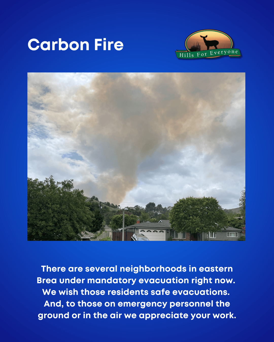
The Carbon Fire has ignited generally across the street from the Chino Hills State Park Discovery Center. Evacuations are underway for several Brea neighborhoods.

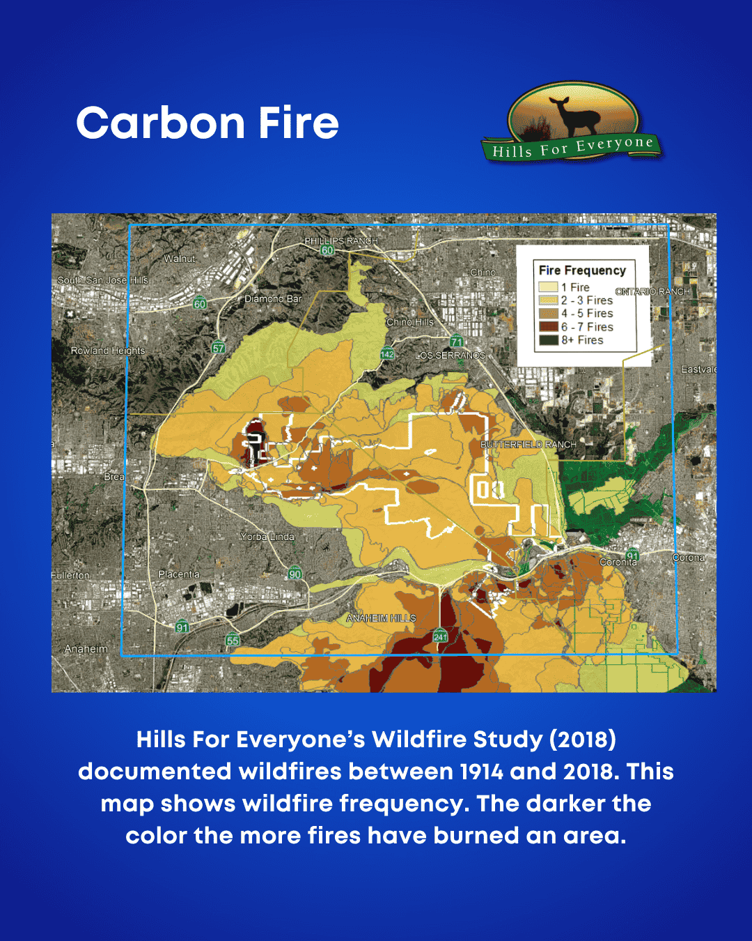
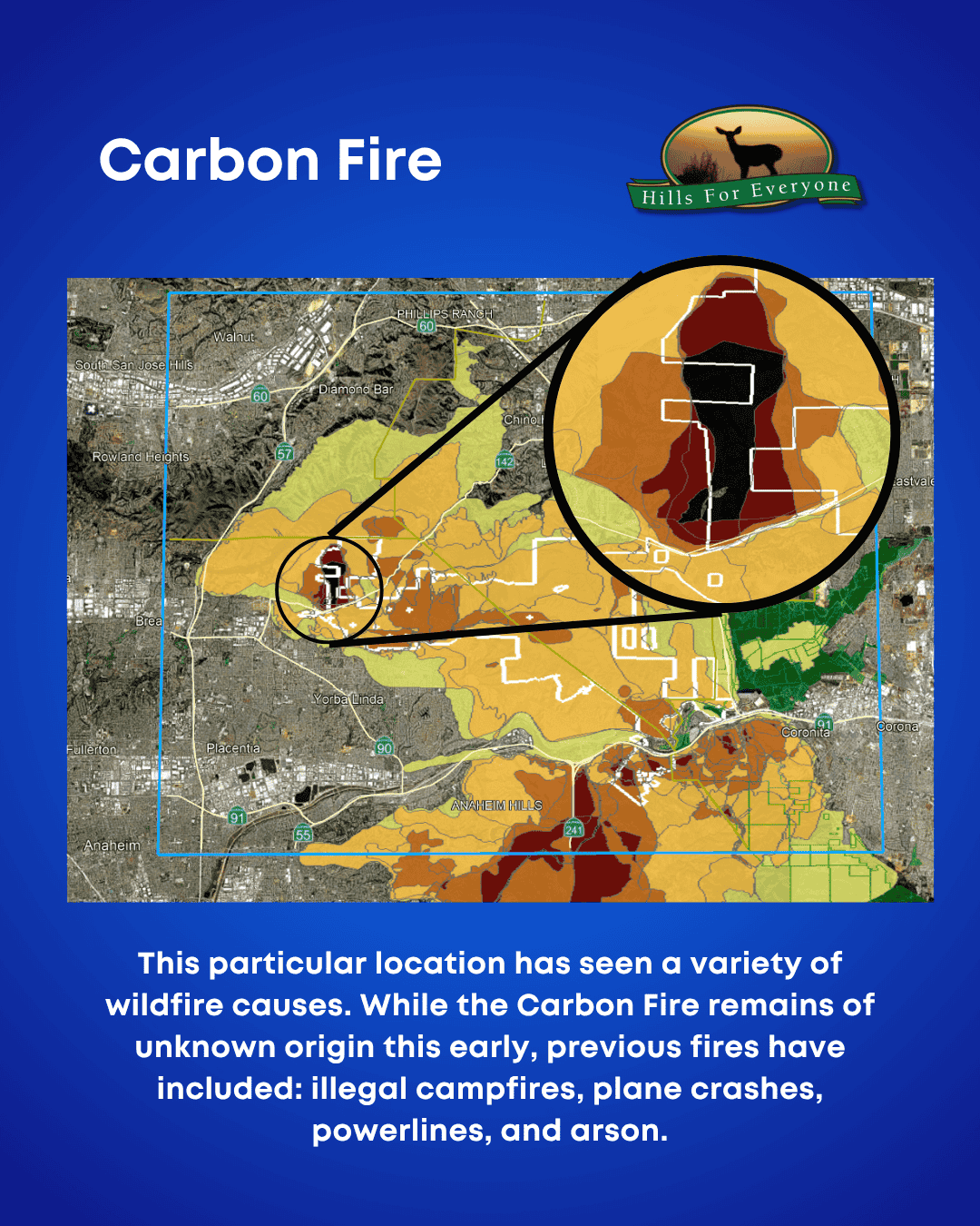
Background: Hills For Everyone completed a wildfire study and this particular area has a high frequency of wildfire ignitions due to a variety of causes. See the 100+ year history of wildfires from our study.

For details, we recommend using the Watch Duty app or the Alert CA wildfire cameras:

Wishing everyone luck in their evacuation or emergency response! 🤞

Against a blue background, the HFE logo is upper right, and the title: Carbon Fire in the upper left. There is a map of fire frequencies in the center. The text reads: Hills For Everyone’s Wildfire Study (2018) documented wildfires between 1914 and 2018. This map shows wildfire frequency. The darker the color the more fires have burned an area.
Against a blue background, the HFE logo is upper right, and the title: Carbon Fire in the upper left. There is a photo of a fire in the distance. The text reads: There are several neighborhoods in eastern Brea under mandatory evacuation right now. We wish those residents safe evacuations. And, to those on  emergency personnel the ground or in the air we appreciate your work.
Against a blue background, the HFE logo is upper right, and the title: Carbon Fire in the upper left. There is a map of fire frequencies in the center with a call out to the current fire location showing many fire ignitions. The text reads: This particular location has seen a variety of wildfire causes. While the Carbon Fire remains of unknown origin this early, previous fires have included: illegal campfires, plane crashes, powerlines, and arson.