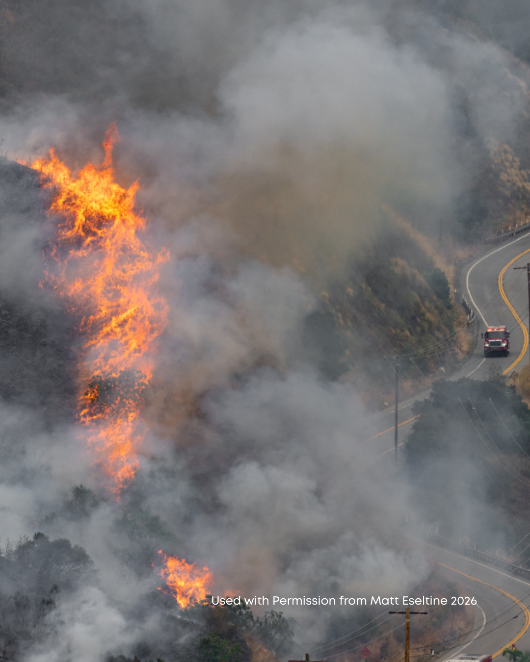
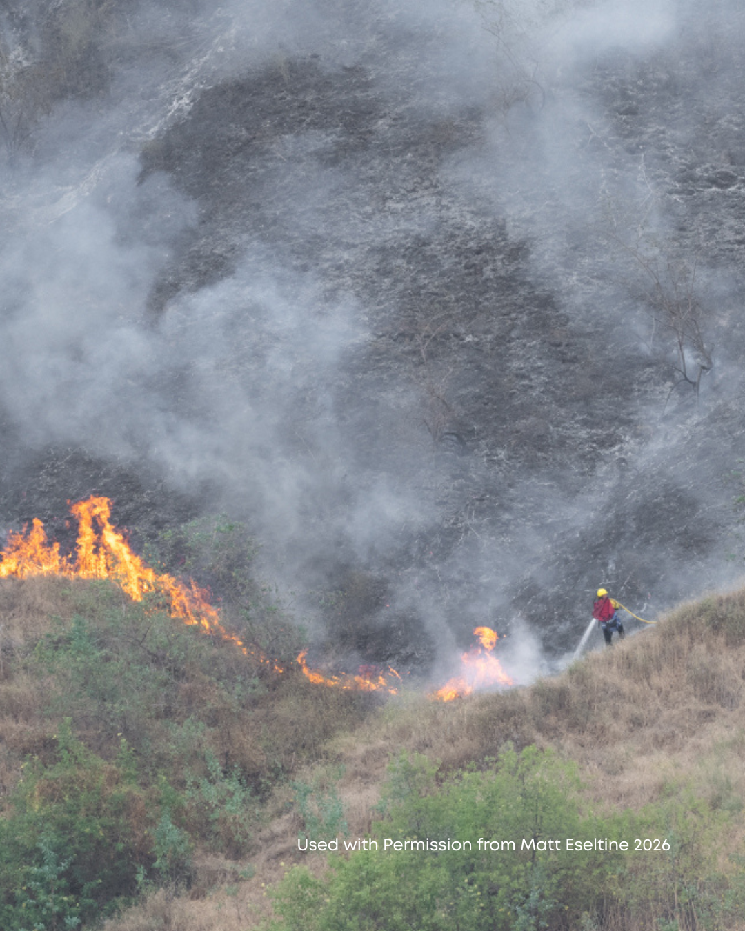
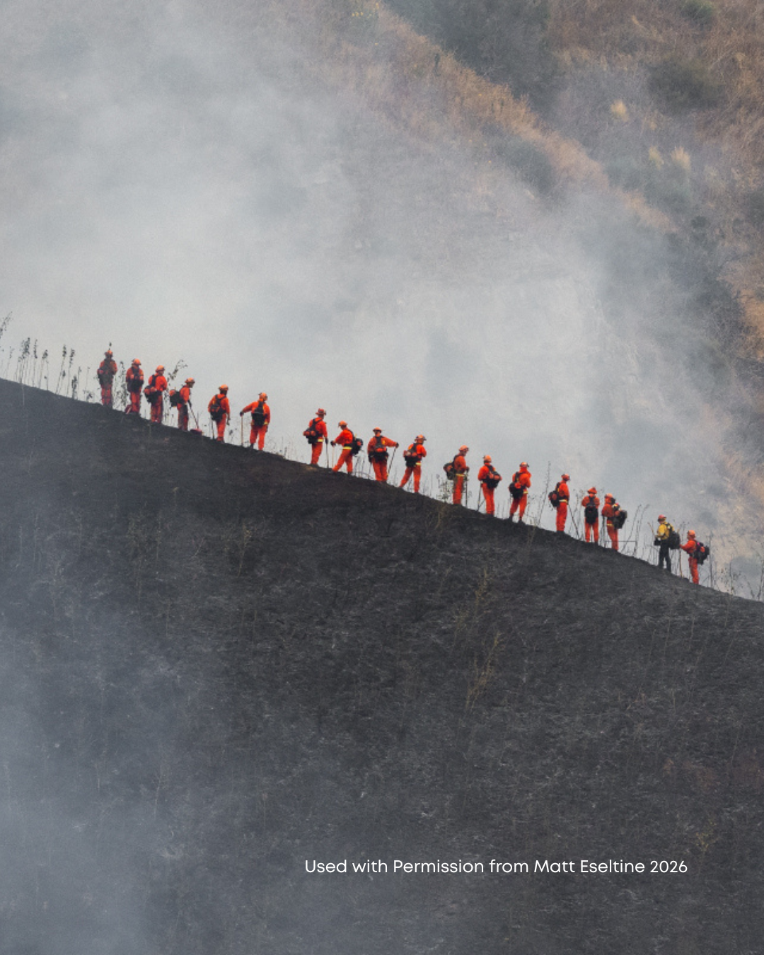
April 25th brought another fire to Chino Hills State Park. It started on the north side of Carbon Canyon Road half way between the Discovery Center and Olinda Village/Hollydale. No homes were damaged or destroyed in this fire. Instead, it burned into what is called the Brea-Olinda Wilderness Park.
That land has been hard fought for. It was first targeted in the late 1970s by the City of Brea to be set aside as the 1,100 acre Brea-Olinda Wilderness Park. Funding was all lined up until a new federal administration came to power and axed the funding source. This was at the same time acquisitions for the State Park had begun. It was also at the same time that the Orange County Sanitation District was looking to expand Olinda Landfill all the way to Olinda Village.
Senator Ross Johnson intervened and added this land as a potential addition to the State Park. In the 1990s, Aera Energy offered to sell the land at a discounted price to the State Park as mitigation for its development of the Vista del Verde project in Yorba Linda. It is now an area governed by a Habitat Conservation Plan, which is a federal level of protection of sensitive plant communities and wildlife.
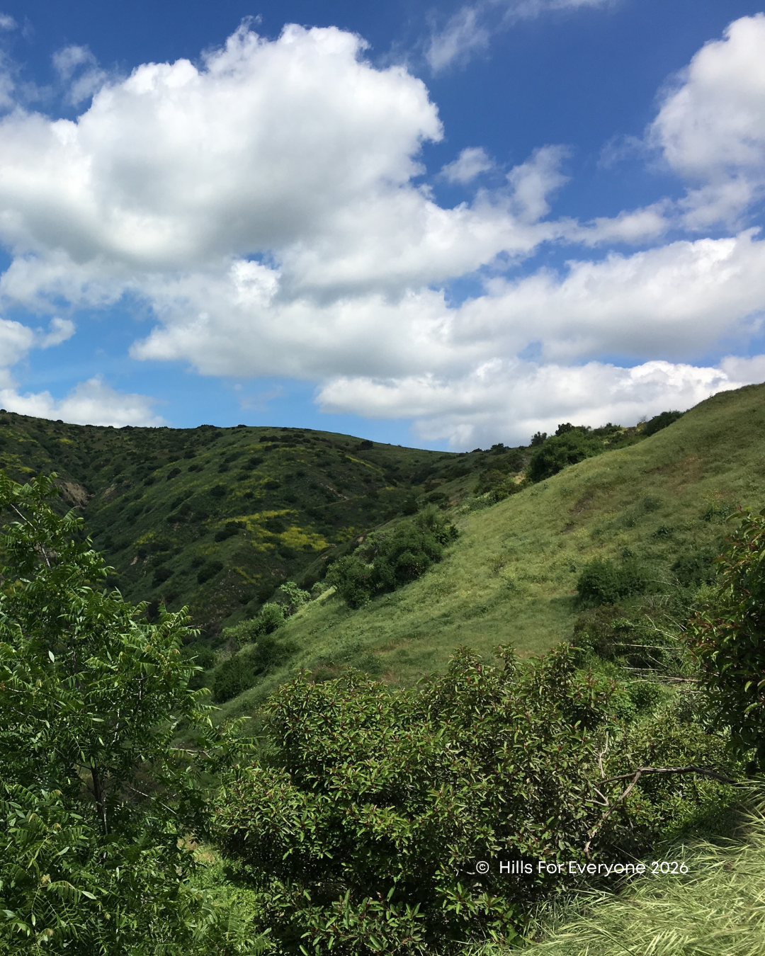
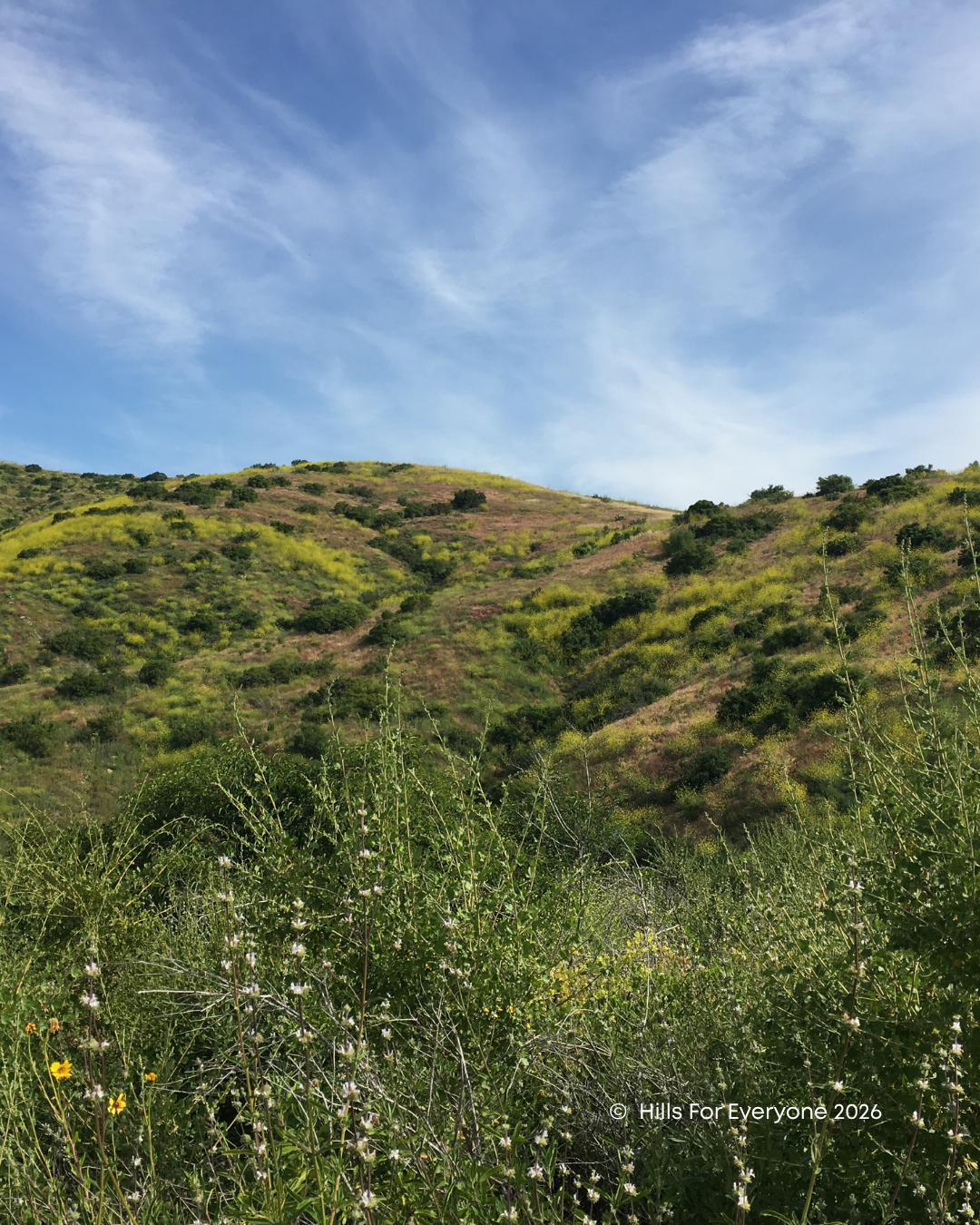
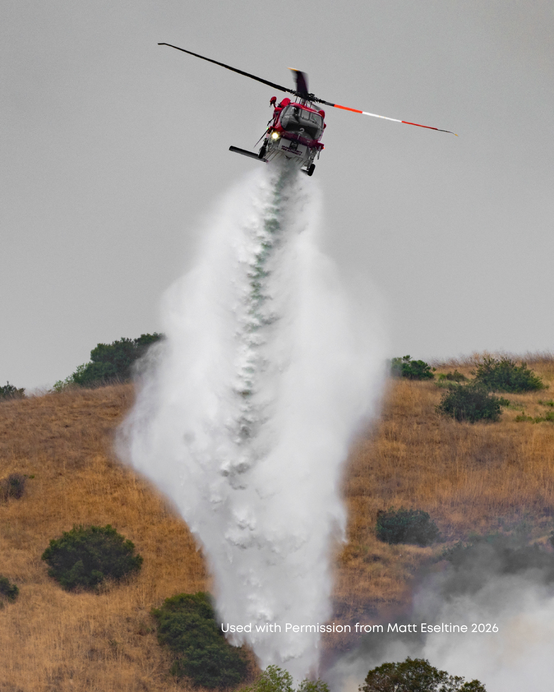
On April 25, 208 acres of this land burned. Multiple agencies participated in the fire fight from ground crews on steep slopes to helicopters and fixed winged aircraft. For the first time in recent memory, suppression repair was performed while the bulldozers were on site. This involves smoothing out the berms that bulldozers create in the heat of battle. This slope repair helps prevent erosion and runoff that could close the road during winter rains. This area of the State Park is prone to fire.
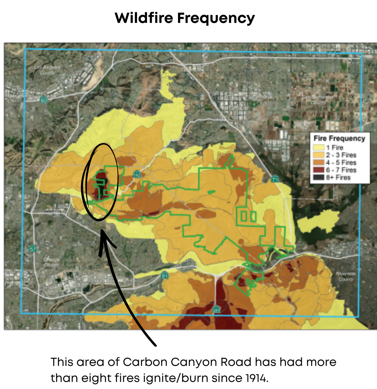
In our Fire Study in 2018, it emerged as a hot spot—a place where many fires have started and which therefore deserves additional attention by fire agencies.
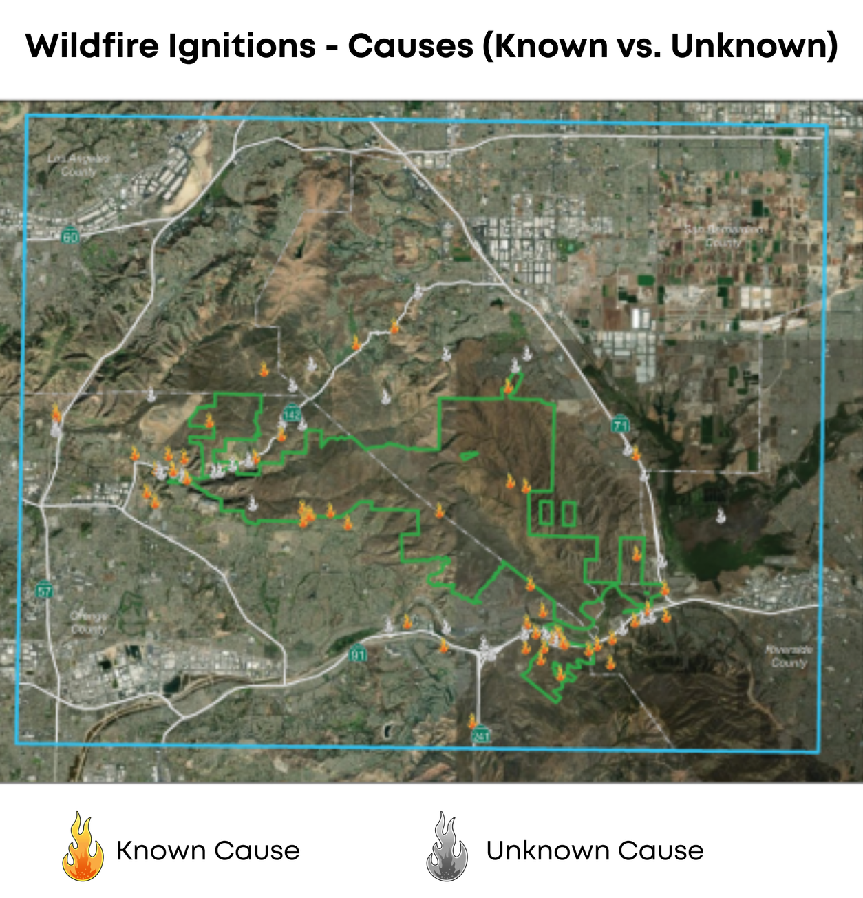
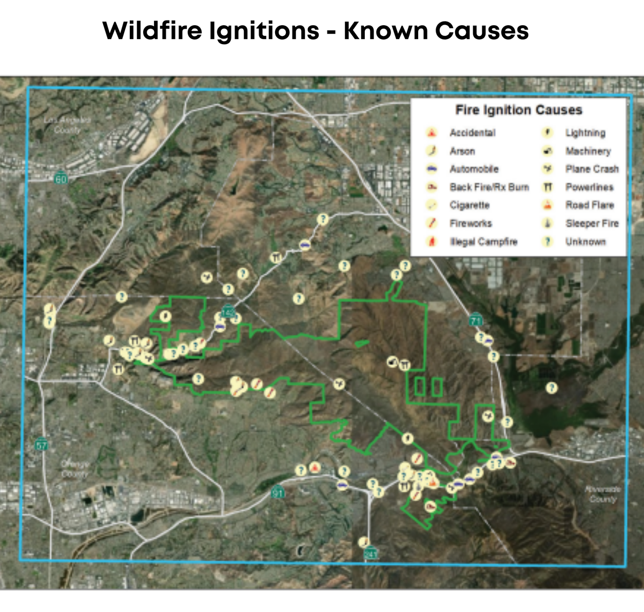
In fact, it is one of three hot spots for fire ignition, with the other two being along the 91 Freeway corridor and over by the Rim Crest area of the State Park in Yorba Linda. (See the first map below) Fires along Carbon Canyon Road have burned more than eight times since data collection began being collected in 1914. The fire ignitions vary from: lightning to illegal campfires, powerline failures to a plane crash.
Download our data as a KMZ file and open it in Google Earth to learn more about local fire perimeters, fire frequency, and fire ignitions.